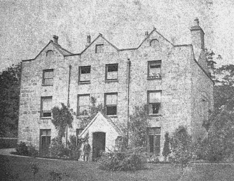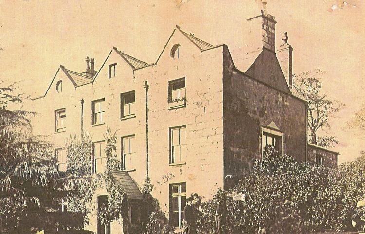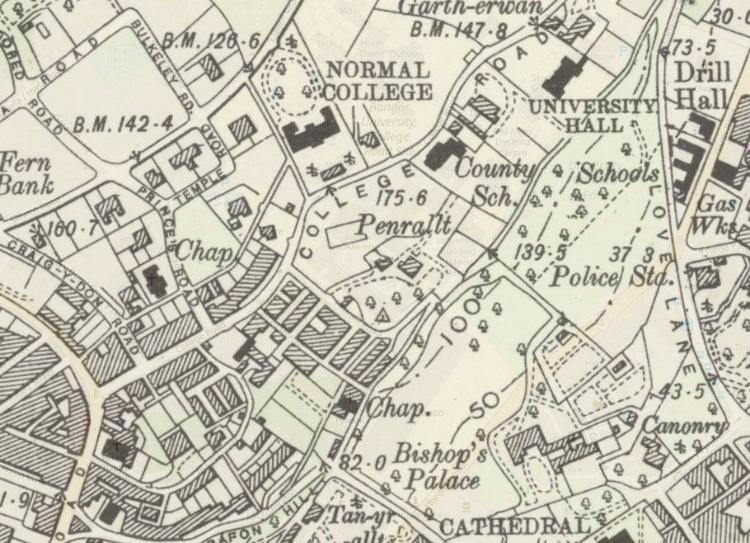
Penrallt, showing on the 1901 OS map.
The photographer was C. Richard of High Street, Bangor and written underneath the photograph is, ‘‘Penrallt, The Property of Lord Penrhyn with the respectful compliments of the Tenants”. (Penrhyn Castle Papers at the University Archives)
The Penrallt Estate had been 200 acres in size, originally part of the Penrhyn Estate. It past to Martha Griffith (1681-1705) an heiress and illegitimate member of the family. Her sons second wife Hephzibah Howard (of Conway) died aged 92 in 1832 resulting in the breakup of the estate into building plots.
The Penrallt Estate land was auctioned off in 1833, it had extended from Garth in an arc to the (now) railway station and included the northern "Aethwy" ridge of the valley. Forming large sections of what is now Garth and Upper Bangor. John Wood's 1834 map notes "This Land to be disposed of for building" across the Garth area, the first to be developed. Soon after developments came on Holyhead Road (already laid down by Telford in 1817) and then the establishment of College Road linking Garth and Upper Bangor. Lord Penrhyn took ownership of the house again which was let, it's final resident being Principal Sir Harry Reichel who relocated to Gartherwen nearby.
Lord Penrhyn sold the house and land to the City Council and in 1904 together with lands belonging to the bishop it was donated to the University College of North Wales, Bangor for the building of the "Main Arts".