Floods in Hirael
|
|
I was looking through some of old phots of Bangor on this site. There is one photo showing floods in Hirael from 1973. Has flooding been a recurrent problem in the Hirael area and if so, why was Hirael prone to flooding.
|
|
|
This post was updated on .
Yes Hirael has been prone to flooding, as parts lay below high tide level.
The problems were in part the result of the River Adda, which flowed from Glanadda down to Beach Road. If high tide coincided with heavy rain, the lower streets would flood. This was partly solved when the beach outlet was widened in the 1930s and then by improvements to the river culvert. image of the Victorian culvert on Flickr : http://www.flickr.com/photos/dune_uk/2836974160/ 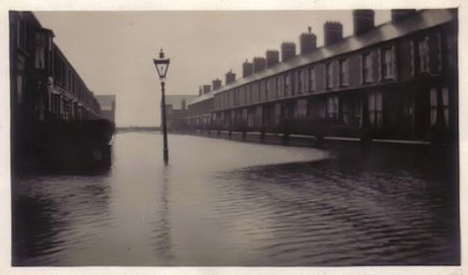 Orme Road The current flood risk... UK Flood Map 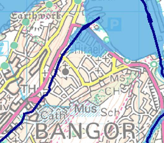 2007 improvements (from GCC site) Environment Agency Wales' and Gwynedd Councils' £8.3m scheme to reduce the risk of flooding in Bangor is progressing well, as the work moves into the second phase of construction. The works, funded by the Agency, Gwynedd Council, the Welsh Assembly Government and EU Objective One money, will eventually mean that 450 homes and businesses in Bangor will be less likely to be flooded from the Afon Adda. The second phase of the scheme includes the construction of a storage area to contain floodwater at Bryn Llwyd, off Caernarfon Road. The Afon Adda is an underground river which flows through Bangor for 4km. It flooded as recently as 2004 causing damage to homes and businesses. This was because the pipes and culverts carrying the water did not have the capacity to cope with heavy rainfall and were also in bad condition. The first phase of the scheme is near to completion, having replaced damaged and narrow pipes with larger ones through the MFI car park, Bryn Llwyd, Ffordd Coed Mawr, Caernarfon Road, St George playing fields and Heol Dewi. Work is still ongoing at Parc Hirael and along Friars Walk. Culverts have also been replaced at Station Road. Gwynedd Archaeological Trust has also taken the opportunity to carry out excavation work around the cathedral to find out more about Bangor's history. Phase 3, which consists of work along Hendrewen Road and Sackville Road, is due to start in October. Keith Ashcroft, the Agency's Area Manager for north Wales said: "This scheme is a huge piece of work but it will make a difference to people living here. The culvert carrying the Adda is quite old and it needed to be upgraded to cope with heavy rainfall. "However, while we can reduce the risk of flooding, people still need to prepare themselves and their property. The flooding we have seen this summer shows that extreme rainfall can cause huge problems. "We are working closely with all councils and emergency services to have plans in place for any flooding events in the area. "People need to be aware of the dangers caused by flooding. To find out more, you should look on our website for advice on what you can do to prepare for flooding at www.environment-agency.gov.uk." Councillor R H Wyn Williams, Gwynedd Councils' lead on the environment said: "Gwynedd Council is very pleased to be working with our partners at Environment Agency Wales on this important project which will bring significant benefit to residents and businesses in the Bangor area. Work is progressing well and we are very pleased to see the next phase of the development starting." ------------------------------- for further details----------------------------- North West Wales Catchment Flood Management Plan Summary Report January 2010 GEWA0110BRKF-E-E.pdf http://www.environment-agency.gov.uk |
|
|
150 Bangor homes and business at risk of floodingAug 1 2012 by Daniel Bissett, Bangor and Anglesey Mail ONE hundred and fifty homes and businesses in Bangor are now at risk of flooding. From October, the Environment Agency will extend warnings to owners of the properties – news which will affect buildings insurance rates, and future development in the city. Residents in vulnerable areas will also be informed about a community flood plan for the city. Environment Agency Wales is developing the plan so, in case of possible flooding, residents are given the best possible advice in how to prepare themselves. Cllr Jean Forsyth, who represents Hirael for both county and city, said: “I think we’ve been needing a new flood plan for years. “There’s been a call for a better wall near The Nelson in Hirael where the slipway is, but, like everything, it costs money. “The culvert has helped with the Afon Adda situation because I remember when the old MFI store was flooded years ago. “But if we get high tides, then the old Dickies Boatyard area is very vulnerable.” Cllr Les Day said flooding was a concern Bangor City Council raised when planning was being discussed for the old boatyard. “We would like to see housing there but we said as a council, there was a risk of flooding,” she said. “They won’t let anybody build on the old Crosville site because of possible flooding and the boatyard area is an even bigger risk.” Eirian Redmayne, from Environment Agency Wales, said: “We have been talking to local residents in Bangor over the past months about the risk of flooding in the area from the river Adda as part of our Flood Awareness Wales campaign. “In October 2012 we will be extending our flood warning service to include more than 150 homes and businesses in Bangor. “This is a free service that gives residents advance notice of when flooding from rivers and seas could happen and gives them more time to prepare. “We are also working closely with Gwynedd Council and Bangor City Council to develop flood plans in the flood risk area of Bangor so that the community and local groups can plan how they can work together to respond quickly when flooding happens.” At a meeting of Bangor City Council’s planning and amenities committee last week, town clerk Gwyn Hughes told councillors of the flood plan. He said: “The Afon Adda has been an issue for many years and there have also been (flood) problems in Hirael. “The Environment Agency are very anxious the community are involved and Gwyn Moseley (from Environment Agency Wales) wants to come to our next meeting and involve members in the agency’s ideas. “The communities most involved will be in Hirael and the area in and around the Afon Adda. We can tell him who the contact points are and then the community can be told and notified by the Environment Agency.” A spokesman from Watkin Jones, developers of the former boatyard, their consultants, Richard Broun Associates, held “several detailed meetings with Environment Agency Wales to establish the C2 line, flood risk assessment and construction levels and the site area being developed at this time is not considered to be at risk from flooding" |
|
|
In reply to this post by Admin (Matt)
I can see there is still a flood threat to Hirael, but to be fair to the Envornment Agency, the threat to other parts of Bangor has been considerably lessened by the scheme they began following the flooding of parts of the Glanadda/ Caernarfon Road and Ffordd Gwynedd near the Public Library in 2006/7. It's worth climbing the hill up to Bryn Llwyd farm to see the impressive holding lake and sluice-gates which now control the volume of water flowing through the Afon Adda. There is also a smaller scheme behnd the terrace houses in Hendrewen.
|
|
|
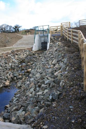 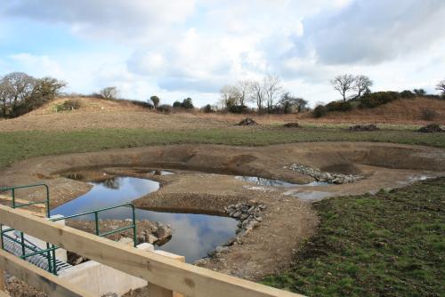 These photos were taken in December 2007 soon after the Bryn Llwyd scheme was completed and by now it should be blending in well with the surroundings. These photos were taken in December 2007 soon after the Bryn Llwyd scheme was completed and by now it should be blending in well with the surroundings.
|
|
|
In reply to this post by Admin (Matt)
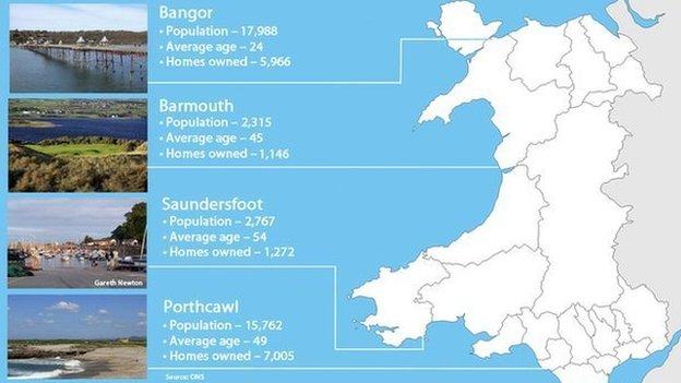 House price fears over plans to end coastal erosion defence http://www.bbc.co.uk/news/uk-wales-29794518 |
«
Return to General Discussions & Ideas
|
1 view|%1 views
| Free forum by Nabble | Edit this page |

